
Grande Traversee des Alps GR5
Hike the GR5 Mont Blanc to Mediterranean Sea
Trip Summary
Much like a European version of the Appalachian Trail, the Grande Randonnee 5 (GR 5) is a spectacular long-distance hiking route that runs the length of Europe, beginning on the North Sea and ending on the shores of the Mediterranean. The section of the GR 5 that begins at the base of the Mont Blanc Massif and traverses the French Alps south to the Mediterranean is referred to as the Grande Traversee des Alps (GTA). We trek this diverse route on foot, hiking to a new destination each night.
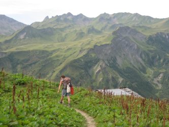
As we are ticking off our landmark villages of Chamonix, Pralognan, Briancon, Ceillac, St. Etienne, St. Martin Vesubie, Sospel, and, finally, Menton, we will be treated to a variety of experiences that only European long-distance footpaths can offer. Twenty-one days are filled with high mountain passes, lush alpine meadows, forest paths, quiet villages, historic cities, rustic refuges, comfortable hotels, local wines, sumptuous cheeses, and most certainly the satisfaction of arriving on foot. This route is traveling “off the beaten path” at its best and promises an immensely rewarding and memorable journey.
We are currently reworking our Grande Traversee des Alpes GR 5 trip and will be reintroducing it in 2020. Stay tuned!
Grande Traversee des Alps GR5 Itinerary
Day 1: Arrive Geneva, Cointrin International Airport. Group transfer at 1:00 pm to Chamonix, France. Welcome dinner and orientation. Chamonix is home a dazzling array of many of the highest peaks in the Alps, including Mont Blanc (15,860′).
Day 2: Hike to Refuge de Miage
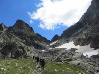
Short transfer by bus to Les Houches and cable car to Bellevue (5,610′). Here we begin today’s hike by passing by the foot of the huge Glacier de Bionnassay, then up through lush meadows to the Col du Tricot (6,995′) with spectacular views of the Aiguille du Bionnassay, Dome du Gouter, and the entire Chamonix Valley. After our steep descent from the Col, we arrive at our refuge.
Elevation gain: 1,386'; Elevation loss: 2,016'; Distance: 5 miles; Time: 3 - 4 hours.
Day 3: Miage to Refuge la Balme
Departing from Les Contamines in mid-morning, we hike up the Mont Joie Valley, past a 15th-century mountain church, Notre Dame de la Gorge, cross a small ancient Roman bridge and continue up this broad alpine valley to our overnight stop.
Elevation gain 2,310'; Elevation loss: 2,178'; Distance: 9 miles; Time: 4½ -5½ hours.
Day 4: La Balme to Refuge Mya
We begin a steady climb to the Croix de la Bonhomme (8,200′). The route from the Refuge de la Croix Bonhomme follows the narrow ridge of the Crete des Gittes, built by the French Military, and then drops down to the Col de Sauce and to the Plan de la Lai (6,000′) and up to the Refuge Mya. Views of Mont Pourri dominate the scenery.
Elevation gain: 3,286'; Elevation loss: 2,500'; Distance: 10 miles; Time: 6½ hours.
Day 5: Mya to La Balme
Our hike today leads us high above the Roseland Dam to the Col Bresson, flanked by dolomite-like arretes and aiguilles, including the bold Pierra Menta. From here, our hike down to the refuge is spectacular. This simple refuge is in a calm and remote setting.
Elevation gain: 3,000'; Elevation loss: 2,603'; Distance: 11 miles; Time: 6½ hours.
Day 6: La Balme to Entre Le Lac
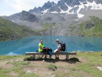
Our day will begin with a long, gradual descent down the valley floor to the village of Valezan. A short bus transfer will take us from Valezan to Peisey-Nancroix and on to the Chalet Refuge de Rosuel, located at the entrance to the Parc National Vanoise. After a rest stop, we head into the park, gaining elevation steadily. The view is stunning as we emerge onto a high, broad valley surrounded by rocky peaks and waterfalls fed by the high snowfields and glaciers. From here we get our first glimpse of the huge Grande Motte rising to over 12,500′! Our rustic refuge, Entre le Lac, lies next to a beautiful blue-green alpine lake.
Elevation gain: 2,050'; Elevation loss: 2,640'; Distance: 9.5 miles; Time: 6 hours.
Day 7: Entre le Lac to Val Claret.
The morning part of the hike climbs up to the Col du Palet (8,750′). The ever-widening valley is flanked by the Dome de Platieres and the tapered peak of Aliet. Up ahead lies the Grande Motte (12,500′), draped with huge glaciers. In the early morning, we are likely to see dozens of marmots, chamois and perhaps some ibex. This is a planned short day but it may very well take longer because it is worth lingering. Overnight in a hotel in Val Claret.
Elevation gain: 1,683’; Elevation loss: 1,815’; Distance: about 4 miles; Time: 4 – 4 ½ hours.
Day 8: Val Claret to Refuge d’Entre Deux Eaux
Today we leave the GR 5 and pick up the high mountain route of the GR 55, which cuts into the heart of the Vanoise. As we hike out of the ski area, the route contours up the Rochers de la Petit Balme and to the Col de Fresse (8,300′). From here the route climbs through the narrow, Vallee de la Leisse, bordered by the Grande Motte on one side and the Rocher du Genepy on the other. Leaving the day-hikers behind at the col, we pass Lac des Nettes before dropping down to the remote Refuge de la Leisse (8,200′). From the refuge, the route continues to follow the quiet, beautiful valley, from the Torrent de la Leisse down to the Pont (bridge) de Mon Croe Vie and our Refuge d’Entre Deux Eaux for the night.
Elevation gain: 900'; Elevation loss: about 2,253’; Distance: about 7 miles; Time: 4½ to 5½ hours.
Day 9: Refuge Deux Eaux to Pralognan la Vanoise
From the refuge, we climb to a high, broad valley lined by several mountain lakes and mountain peaks of Pointe Mathews (12,334′) and La Grande Casse (12,721′). The trail then rises to the Col de la Vanoise (8,300′) and the Refuge du Col de la Vanoise. From here there are spectacular views of the Glaciers de la Grande Casse and des Grands Couloirs. Rounding the very prominent Aiguille de la Vanoise, we hike down to the mountain village of Pralognan (4,680′). Arriving in Pralognan in the mid-afternoon, we'll have time to stroll around this pretty village. Hotel with private bathrooms.
Elevation gain: 1,535'; Elevation loss: 4,000'; Distance: 12 miles; Time: 5 to 6 hours.
Day 10: Pralognan – End of Part 1 and Start of Part 2
For those hiking all the way to the Med, today is a rest day. For those departing there will be a group transfer to the Geneva Airport departing about 9:00 am and arriving at the Geneva Airport at about 11:00 am. We will rendezvous with those joining the trip at the Geneva Airport at 11:00 am for a group transfer to Pralognan. Please contact us before firming up any travel plans.
Day 11: Pralognan to Chateaux Ville – Vieille - Chateaux Querayas
Leaving Pralognan in the morning, a short transfer by bus takes us to the edge of the park, where we begin our hike in the Vallon du Doron to the Col de Chaviere. This col is the highest col of any of France’s long-distance routes (9,230′) and offers an impressive view of the Mont Blanc Massif, over 100 miles away. At about 3:00 in the afternoon we will meet our van for transfer to our overnight stop in Chateaux Ville Vieille. Transfer time is 2 1/2 – 3 hours.
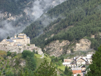
Chateau Ville Vieille Queyras is situated just outside of the Parc Naturel Regional du Queyras. This chateau, dating back to medieval times, was rebuilt by Vauban as an important part of his grand defense scheme. Within this isolated region are beautiful mountains, torrents, and rivers, wheat fields, larch and pine forests, varieties of wildflowers and centuries-old farmhouses clustered around ancient chapels. Woodcarving keeps the local population busy during the long winter. (Keep some extra room in your pack!) Overnight in a gite d’etape.
Elevation gain: 3,400’; Elevation loss: 3,100'; Distance: 10 miles; Time: 6½ hours.
Day 12: Chateaux Ville-Vieille to Ceillac
From Chateau Queyras we climb through forests and wide meadows offering dramatic 360-degree views. Above us tower the twin peaks of Pointe de la Selle and Point de Rasis. This path soon takes us over the open and barren pass at the Col du Fromage (7,600′), and yes, “fromage” means cheese! From the col, we descend steeply to Cristillian River and then to the historic village of Ceillac. Overnight in a gite d’etape.
Elevation gain: 3,200'; Elevation loss: 3,200'; Distance: 8.5 miles; Time: 6 hours.
Day 13: Ceillac to Maljasset
The first part of our hike passes by Lac Mirror and Lac St. Anne, surrounded by the rocky mountains of Pic Heuvieres. This area has a very remote feeling as we cross Col Girardin (8,900′) and descend into the quiet Ubaye Valley to our gite at Maljasset.
Elevation gain: 3,500'; Elevation loss: 2,600'; Distance: 10 miles; Time: 5½ hours.
Day 14: St. Etienne de Tinee
We will start with a morning hike to St Paul Ubaye, where we will have lunch at a local restaurant. After lunch, we will meet our van and transfer to St. Etienne, where we will spend the night at a gite d’etape, located a short walking distance to the village.
Day 15: St. Etienne to Vignols
Today’s hike is spectacular and probably a favorite because of the remoteness, the changing scenery, and the welcoming gite at the end of a good day. After a short transfer, we hike through larch forests along the Sellevielle River and through a huge cirque up to the Plateau of Combe de Crousette. Ahead lies the enormous wall of Mont Mounier. Shaped like a whale, this distinctive mountain has been in view for several days and will continue to mark our progress. After reaching the col at Stele Valette, which offers immense views including the Merveilles Valley and possibly a glimpse of the Med, we begin our descent to the Valley of Gourgette and to our overnight stop at a gite d’etape in Vignols.
Elevation gain: 3,400'; Elevation loss: 3,177'; distance: 9.3 miles; Time: 6½ hours.
Day 16: Vignols to Roure, transfer to Rimpla
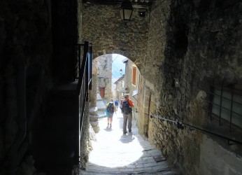
Today’s hike is filled with contrast. The first part of the day leads us through a wonderful, high, open meadow. The second part of the day leads through hamlets, villages and by ancient churches. We end the hike in Roure. This village sits on a hillside and is known for its churches, chapels, frescoes, and altarpieces. After a look around this very pretty village, we will meet our van and transfer to our overnight stop in Rimplas. At this point, the scenery takes on a decidedly more Mediterranean air, with olive trees, lavender and hardwood trees. Overnight in a small hotel.
Elevation gain: 1,100’; Elevation loss: 2,650'; Distance: 8 miles; Time: 4 hours.
Day 17: Rimplas to Sospel
Morning transfer from Rimplas to our trailhead. From our overnight stop we hike south round the Terres Rouges and to our ending point at Point Trois Commune – l’Authion. As with all our days, this hike is varied, as our route includes forest roads, pleasant paths that contour the mountains, great views and of course some climbing as we reach the mountain passes at Col de Raus and Baisse de Saint-Veran. On the main peak of l’Authion, there are several old military installations from where the Free French Army dislodged the Germans in 1945. There are great views of the whole Alpes-Maritimes. Even though the Mediterranean Sea is just around the corner, the mountains are still quite impressive and the route is still open, offering views in every direction. From Trois Commune, we meet our van and transfer to our gite in Sospel.
Elevation gain: 2,600’; Elevation loss: 2,200'; Distance: about 12 miles; Time: 4½ – 5 hours.
Day 18: Sospel to Menton
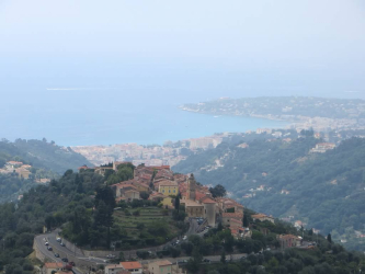
It’s never over ’til it’s over, and we’re not out of the mountains yet. From Sospel we climb through an amazingly dense forest before the route opens up at the Col Razet, where we have our first view of Menton. It looks very close, but today’s hike is a long one. The terrain and vegetation have changed for good: scrub pines, terraced landscapes, white rocky outcroppings and steep, short mountainsides. With Menton in sight, the trail still remains empty of other hikers. Trekking past old farms that gradually give way to suburban homes, our final descent to the sea begins in Castellar, where the trail becomes a sidewalk. Though no less interesting, the route weaves through the narrow streets of Castellar and then Menton, finally arriving at the beach! This last part of our hike is a wonderful finish to a great day and a great journey! Farewell dinner!
Elevation gain: 2,900'; Elevation loss: 3,630'; Distance: 14 miles; Time: 6½ - 7 hours.
Day 19: The trip will end at the hotel in Menton.
Additional Information
SOLO TRAVELERS
If you wish to have your own room, there is a single room supplement fee. Please let us know at the time of registration if you would like a single room. Single rooms are limited.
If you are traveling alone and would like to share a room, we will match you with a roommate. If there is no one with whom you can share, a “forced” single" fee will apply.
PLEASE NOTE
- There may be changes or modifications to the itinerary.
- Transfers: We have done our best to limit the number of transfers, but it is impossible to complete this wonderful journey without them. The distances combined with the scarcity of appropriate overnight accommodations make transfer necessary. Many, but not all, days will either start or end with a transfer.
INCLUDED
- Group transfers
- All accommodations
- All breakfasts
- Most dinners
- All group transfers on vans, buses, trains and ski lifts as described in the itinerary
- Luggage transfer for one medium-sized duffel bag from your starting point to Pralognan and from Pralognan to Menton
- Guide/s
- Great hiking and memories!
NOT INCLUDED
Airfare, lunches, optional/individual transfers or excursions, dinners in Tignes or Pralognan, items not on set dinner menu, tips to guides/leaders, beverages, insurance, excess baggage charge, items of a personal nature.
LUGGAGE
This hike is not vehicle supported. You will need to carry a small- to moderate-sized pack with all the clothing and accessories you will need for the duration of the hike. (See our sample packing list.) With advances in synthetic clothing and other travel gear, it’s possible to keep your pack weight to 20 lbs., including lunch and water. Any extra luggage or belongings you may have will await you in Pralognan and then again at the end of the trip in Menton.
ACCOMMODATIONS AND FACILITIES
Hotels are generally 2- or 3-star hotels, most with private baths. Breakfasts are served at the hotel. Some are more simple 2-star hotels with shared baths.
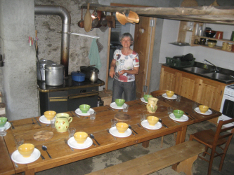
The mountain huts or refuges and gite d’etapes (overnight accommodations for travelers) have their own charm and unique character. All are remote and located in spectacular settings. The shared facilities are simple, but most have hot showers. Most accommodate from 20 to 40 hikers, sometimes more.
Breakfasts and dinners are served at the hotels or refuges and lunches are picnic style along the trail.
TRAVEL
It is easiest to fly to Geneva. However, there are frequent trains from Zurich or Paris; just be sure to allow for extra travel time. Included in the trip cost is a group transfer from the Geneva Airport on Day 1 for those either hiking the entire trip or just Part 1.
WHO WOULD LIKE THIS HIKE?
Our Grande Traversee of the Alps, the GR5 – GR 55, is an exceptional hike. This varied, remote and sometimes strenuous route is great for the hiker who looks forward to wonderful, challenging days and likes the thought of staying in some remote and rustic refuges and small, family-run hotels. This route is definitely off the beaten path.
WHAT MAKES THIS TRIP DIFFERENT?
There are other companies that offer hiking trips from Chamonix to the Mediterranean, but none offer as much hiking and as little driving within such a relatively manageable time frame. No other company maintains the greater integrity of the GR 5 – GR 55 to the extent that we do. Sure, it means that you have to carry your own pack, weighing up to 20 lbs., but it’s well worth it for the experience of a true journey and authentic adventure.
MEETING POINT
If you are hiking the entire route or just Part 1: Independent travel to Geneva airport at 1:00 pm on the first day for a group transfer to our hotel in Chamonix.
If you are joining the second part of the hike – Part 2: Group Transfer from the Geneva Airport to Pralognan. Please contact us for travel information. We are happy to help.
ENDING POINT
Part 1 Only: Group transfer to Geneva Airport.
For those hiking the entire route: Our Grande Traversee of the Alps will end at the hotel in Menton on the last day of the trip. From Menton there are shared vans, buses, trains or taxis to Nice and other parts of Europe. The Nice Airport is 1 hour away by shared van, bus or taxi from the hotel.
MORE INFORMATION
Please contact us for a more detailed itinerary, for more information, or to register. We're also happy to supply a list of past participants willing to share honest insights into this guided GTA Hike experience.
How to Reserve This Trip
A deposit of $500 along with your completed registration forms will reserve a space on your requested trip. We accept MasterCard, Visa, and American Express card as well as personal checks. To make a deposit, you may either follow one of the “Reserve a Trip” links below, give us a call at 1-888-845-5781, or include your payment information in the area provided when completing your registration forms.
The balance is due 90 days prior to departure for most of our trips. When applying less than 75 days prior to departure, full payment is due. For final payments, we accept MasterCard, Visa, and American Express, as well as personal checks.
As confirmation of receipt of your deposit, we will send you a comprehensive packet of information pertaining to your trip, an invoice for final payment and additional information including release agreement form, medical information form, travel information, and packing list. Upon receipt of final payment and no later than 30 days prior to your trip start, you will receive trip rendezvous information and a list of accommodations. Returning trip participants will receive a 5% discount on most trips.
Receipt of all forms will finalize your registration.
Related Trips
 The Dolomites' Alta Via 1 Hut-to-Hut
Hike Italy's premier long-distance route through the Dolomites
The Dolomites' Alta Via 1 Hut-to-Hut
Hike Italy's premier long-distance route through the Dolomitesmore
Strenuous, Strenuous Plus
How to Reserve This Trip
A deposit of $500 along with your completed registration forms will reserve a space on your requested trip. We accept MasterCard, Visa, and American Express card as well as personal checks. To make a deposit, you may either follow one of the “Reserve a Trip” links below, give us a call at 1-888-845-5781, or include your payment information in the area provided when completing your registration forms.
The balance is due 90 days prior to departure for most of our trips. When applying less than 75 days prior to departure, full payment is due. For final payments, we accept MasterCard, Visa, and American Express, as well as personal checks.
As confirmation of receipt of your deposit, we will send you a comprehensive packet of information pertaining to your trip, an invoice for final payment and additional information including release agreement form, medical information form, travel information, and packing list. Upon receipt of final payment and no later than 30 days prior to your trip start, you will receive trip rendezvous information and a list of accommodations. Returning trip participants will receive a 5% discount on most trips.
Receipt of all forms will finalize your registration.
 Hiking the Haute Route
 Tour du Mont Blanc